Offering a glimpse into the future of cycling in Santa Clare County, a tour recently took place along part of the route planned for VTA's Central Bikeway.
The guided ride, organized by the San Francisco Bay Area Planning and Urban Research Association (SPUR), previewed a portion of the route that will be part of the cross-county protected bike path.
Separated bikeways benefit everyone. According to the Silicon Valley Bicycle Coalition (SVBC), protected bike lanes close gaps in the bike network and encourage more people to choose active transportation while improving predictability and safety for motorists.
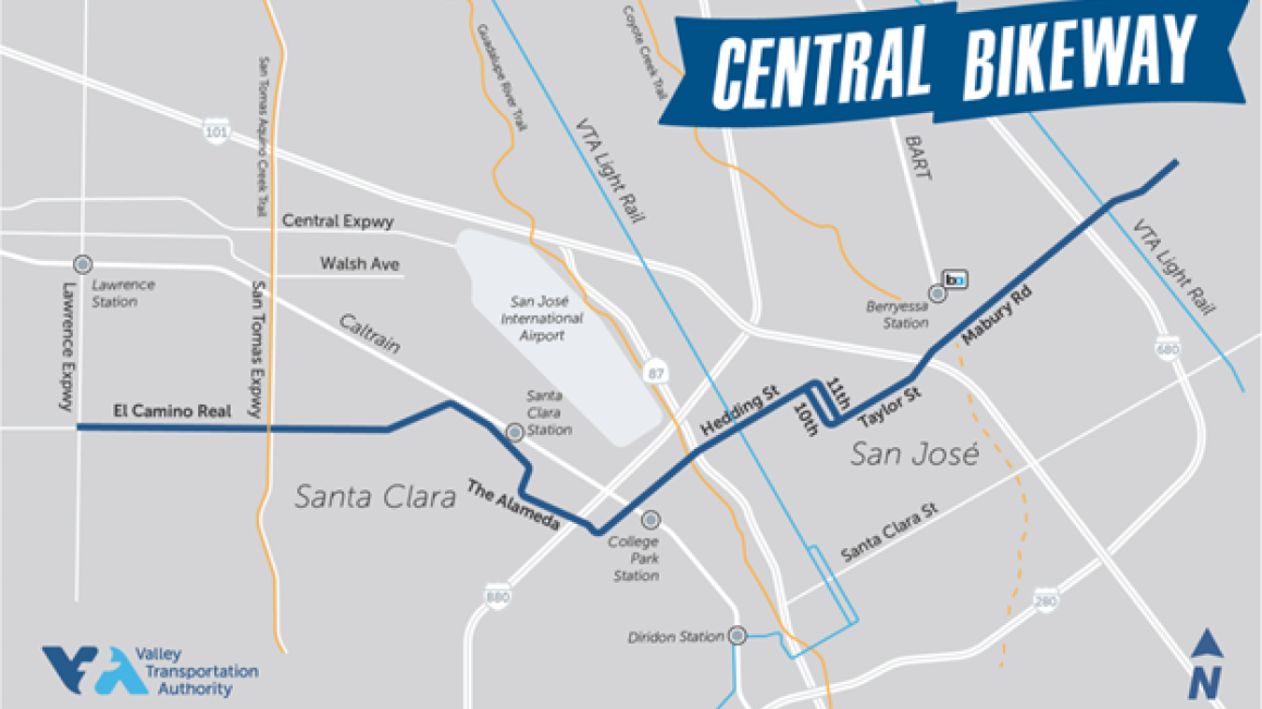
The Central Bikeway Project is a cornerstone of Santa Clara County’s future bike network. Once complete, it will serve as the county’s first on-street bicycle highway, linking essential services, jobs, schools, trails, open spaces, and transit hubs. The project reflects years of planning and extensive community input to ensure it meets the needs of a wide range of users.
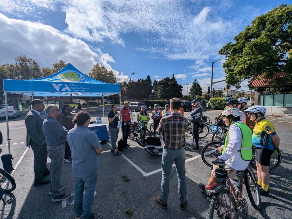
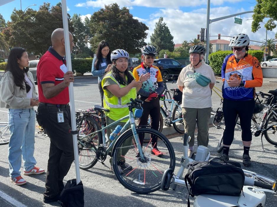
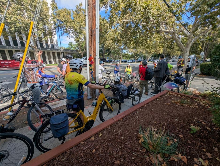
The ride began at the Santa Clara Transit Center, where VTA project managers Lauren Ledbetter and Hassan Basma provided an overview of the planning process and proposed improvements. Tony Le from the Silicon Valley Bicycle Coalition followed with a pre-ride safety check before the group set off.
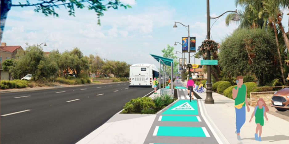
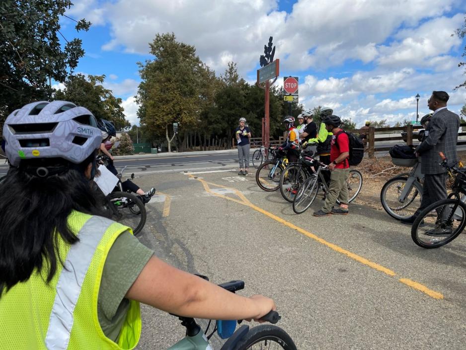
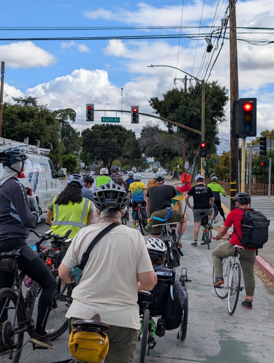
Riders of all ages and backgrounds pedaled south along El Camino Real at a casual pace. After crossing Highway 880, one of several existing barriers for cyclists, the group turned east onto Hedding Street to stop and hear about proposed improvements, including a sidewalk-level bikeway on El Camino Real designed to improve safety and comfort.
The next stop was the Guadalupe River Trail entrance, where riders learned how this trailhead connects to major regional destinations, including Diridon Station, San José International Airport, Levi’s Stadium, Sunnyvale Baylands, Moffett Business Park, Shoreline Park, and the Don Edwards San Francisco Bay National Wildlife Refuge. As part of VTA’s Bicycle Superhighway network, these connections offer a safe, reliable alternative to driving.
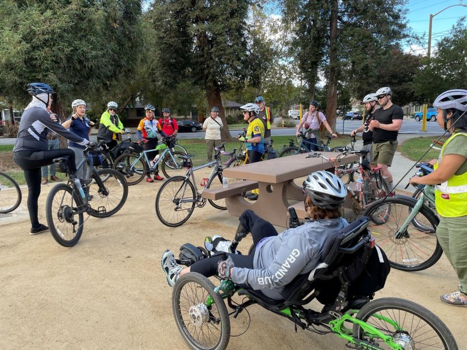
The final stop was Ramond Bernal Jr. Park in Japantown, where participants learned about planned raised crosswalks to slow vehicle speeds at turns, as well as design challenges related to parking and waste collection. From there, the Central Bikeway will continue along 10th Street to Taylor Street, cross Highway 101, and connect directly to the Coyote Creek Trail. Just beyond the trail lies the Berryessa/North San José Transit Center, which features both BART and VTA bus service.
With favorable weather, well-informed guides, and engaged participants, the tour provided a firsthand look at how the Central Bikeway will create a safe, comfortable, and low-stress bike route for people of all ages and abilities.
For more information about the VTA Central Bikeway Project, including maps, project updates, and proposed improvements, please visit the project webpage.