Los Angeles, California, USA - South Figueroa Street
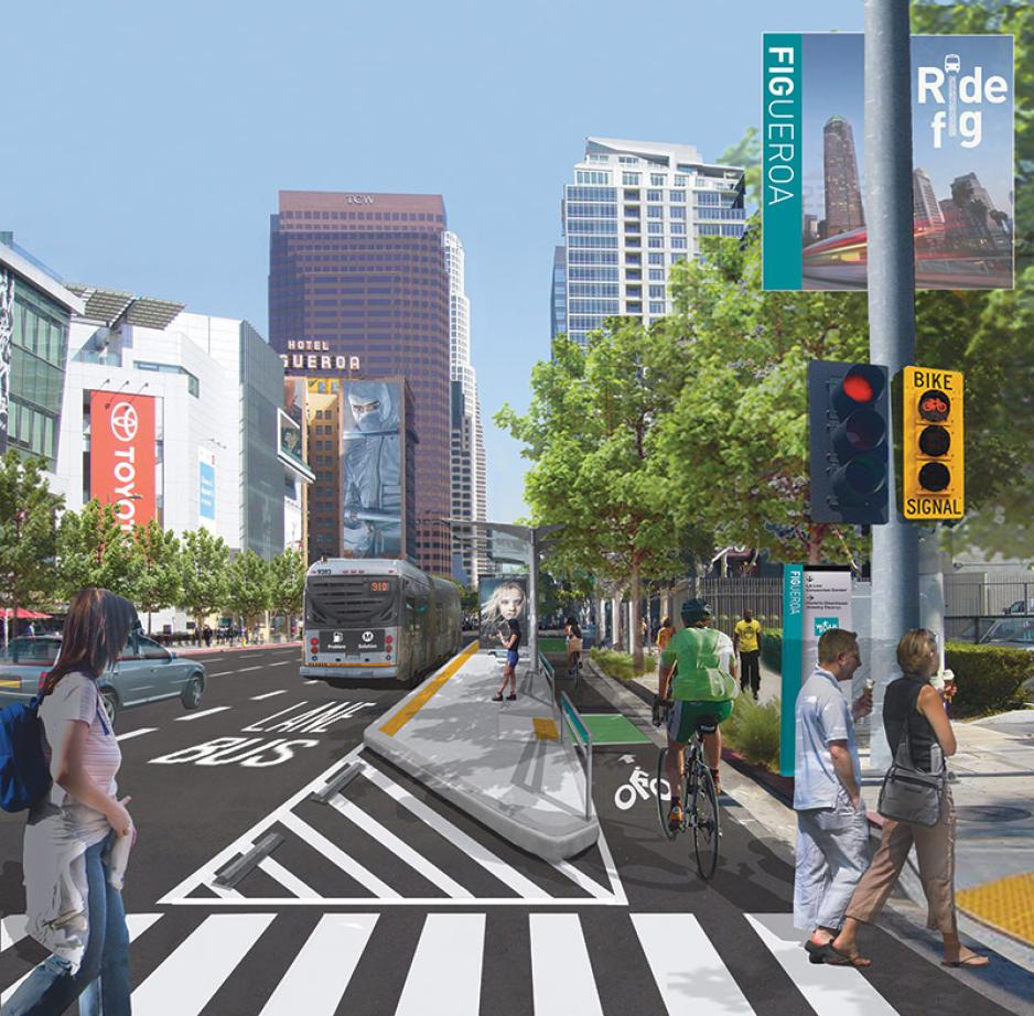
The Figueroa Corridor Streetscape project transformed the public realm of a four- mile stretch of Los Angeles into a complete multimodal street between 7th Street and Martin Luther King Jr. Boulevard – from Downtown to Expo Park. The transit and pedestrian access improvements along with the protected bike lanes, lane and traffic signal modifications, high-visibility crosswalks, transit platforms, street trees, public art and wider sidewalks, all contributed to a stronger, more vibrant public life.
The $20 million, decade-long Figueroa Corridor Streetscape project provides safe, pedestrian friendly public realm and is anticipated to be used as a dedicated central pedestrian corridor, linking all the Downtown LA venues together during the 2028 Olympic & Paralympic Games.
Part of Los Angeles’ complete streets program, the new and improved streetscape enhances Figueroa to better serve the mix of pedestrians, bicycles, vehicles, transit and businesses that use this key corridor. This public realm investment is a significant step in making downtown LA less car-centric and improving public life.
Chester, England, UK – Frodsham Street
Originally a narrow, secondary retail street dominated by charity and bargain shops, Frodsham Street underwent a complete transformation, creating an attractive new gateway to Chester city centre. This transformation originated with the relocation of the Chester Transport Interchange to the northern end of Frodsham, providing an opportunity for Cheshire West and Chester Council (CWAC) to pursue improvement of the street’s pedestrian environment, as it would become the main route to the retail and historic core of the city.
The original Frodsham Street saw large numbers of people using the street as a movement corridor, but with narrow pavements and regular bus traffic, it was not a place to spend time or money in. Although vehicle numbers and speeds were low, they degraded the pedestrian environment and created a street people tended to pass through.
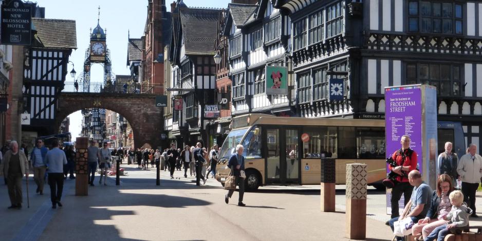
Frodsham street was designed to deliver a Pedestrian Priority Scheme; a form of shared space where the urban environment appears pedestrianized, encouraging people to dwell in the space and drivers to navigate it in an appropriate manner. New seating is positioned in the effective carriageway to communicate to drivers that the whole width of the street is for pedestrians, creating social areas and opportunities for rest.
A series of unique totems were designed for the space, highlighting architectural features found across the historical city. The totems discourage traffic from encroaching on pedestrian-only zones down either side of the street. A tactile strip guides blind/partially sighted users within these zones, which are completely free of any street furniture making navigation straightforward.
By designing for people, this formerly car-centric environment was transformed into a desirable destination that is comfortable and easily navigated, improving public life while encouraging public transportation.

