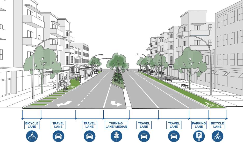
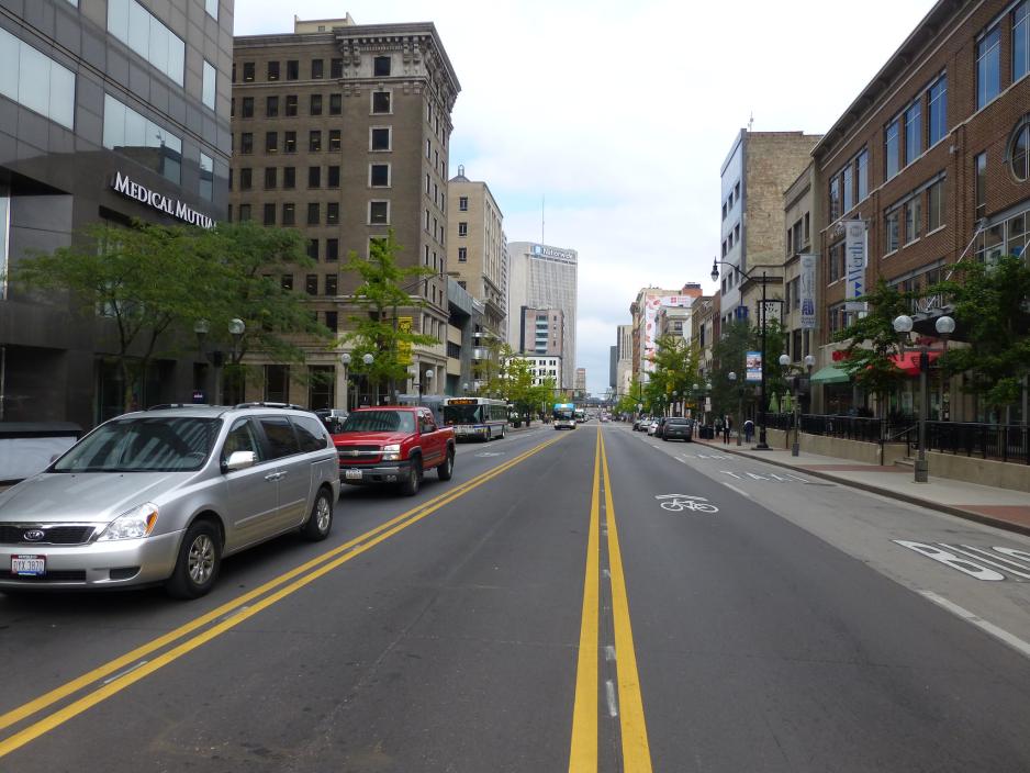
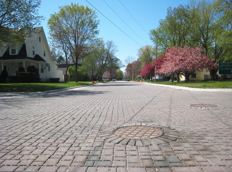
The travelway is the section of the street in which vehicles travel, and includes bicycle lanes, travel lanes, turning lanes, and medians. The design of the travelway is related to the street’s vehicle traffic capacity and design speed, and needs for transit vehicles, bicyclists, and emergency vehicles.
Travelway design dictates how people use the street. Wider streets and multiple lanes permit faster driving speeds and inhibit pedestrian and bicycle movement. Travelway design also determines how people perceive the street as a place. Narrower streets with fewer lanes, together with pedestrian environment improvements that provide pedestrian comfort, convenience and safety all contribute to making a street a place for people.
Design narrower travelways. Travelway width affects pedestrian crossing distance and vehicle speed, but also the street’s sense of enclosure, visual appearance, and perception as a barrier. Wide travel lanes are sometimes necessary to accommodate large trucks, buses, and high-speed travel. However, lanes are often oversized, designed for vehicles that do not frequently use it.
- Use narrower lane widths on some streets. The American Association of State Highway and Transportation Officials (AASHTO) recommends 11-foot lanes on arterial streets that do not carry substantial truck traffic. On low-speed, low-volume collector streets without transit, 10-foot lanes are acceptable.
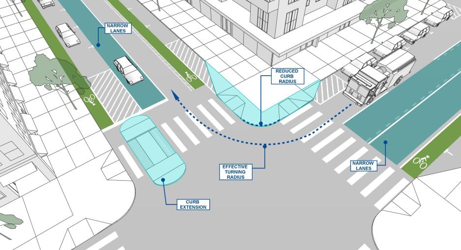
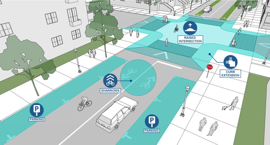
- Physically narrow the travelway in strategic locations. Retrofit existing travelways by adding traffic calming or other design elements that narrow the travelway in strategic locations, such as raised median treatments, on-street parking, planted curb extensions, wider planting strips, or wider sidewalks.
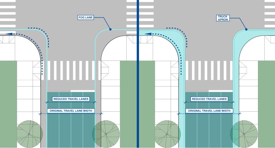
- Stripe the lanes. If the curbs cannot be moved because of cost or other considerations, appropriate lane striping can help reduce the perceived width of the street, inducing drivers to drive slower. These are sometimes called “fog lines.”
- Reduce curb-return radii for street intersections. Large curb radii allow drivers to make high-speed turns, creating inhospitable and dangerous conditions for pedestrians and bicyclists. In an urban context, curb radii can range from 5 to 25 feet, with 15 feet or less preferred. To accommodate fire equipment, buses, and delivery trucks and other large vehicles, consider using devices such as paint and flexible posts, truck aprons, or mountable curbs.
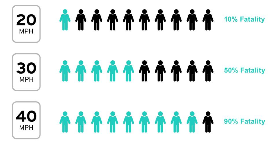
Reduce travel speeds. It is well established that the risk that a pedestrian struck by a vehicle will be injured or killed is related to the impact speed. Pedestrians hit by a vehicle traveling 20 mph at impact have a 10% chance of being killed, but the risk of death increases quickly. At an impact speed of 30 mph 50% of pedestrians will be killed, and at an impact speed of 40 mph, 90% of pedestrians will be killed. Slowing vehicle speeds dramatically reduces the risk for pedestrians and creates a safer public space.
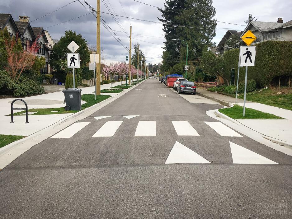
- Use physical devices to reduce design speeds and calm traffic. Install devices that deter speeding such as speed humps, speed tables, raised intersections, traffic circles, choke points, and chicanes. Many traffic calming devices can be designed to accommodate larger or emergency vehicles such as slotted speed humps and roundabouts with aprons.
- Accompany traffic-slowing devices with devices that deter cut-through traffic. Devices such as diverters, semi-diverters, and full and partial street closures can protect neighborhoods from cut-through traffic while allowing bicyclist and pedestrian access.
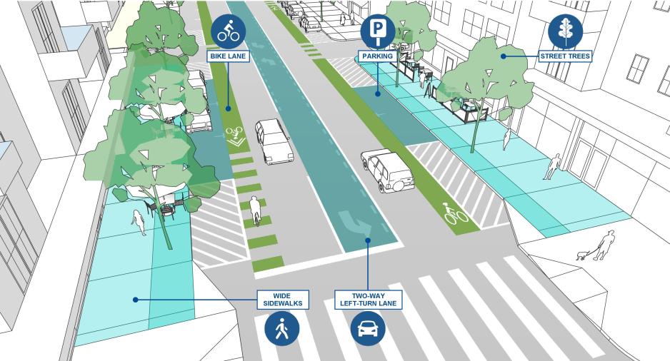
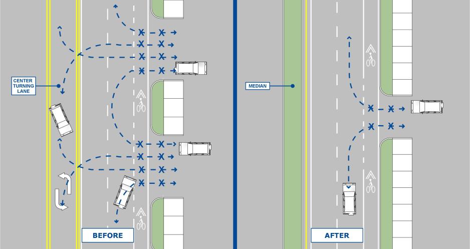
- Remove travel lanes from a roadway and use space for other uses. This reallocation of roadway space—road diets—can operate well and improve safety for all road users. Converting a four-lane undivided roadway into a three-lane roadway with one lane in each direction separated by a two-way left-turn lane can reduce crashes by 19% to 47% and reduce speeding by 7%. The Federal Highway Administration (FHWA) advises that roadways with average daily traffic of 20,000 or less may be good candidates for a road diet.
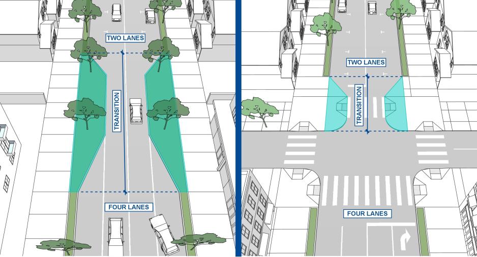
- Use transitions as signals to slow down. Transitions serve as visual cues to identify a change in street type, street character, or area and to warn drivers to slow down. They include gateway, streetscape or landscape features, changes in street cross sections, or changes in paving surface or elevation.
- Build a street canopy with street trees and buildings close to the travelway. A canopy provides a sense of enclosure, conveying to drivers that they are navigating through a populated area rather than open road. Street trees planted in raised medians help to provide a sense of enclosure on wider streets.
- Provide streetscapes and outdoor activities that invite drivers to slow down. On-street parking, outdoor café seating, and street furniture add activity beside the street, signaling drivers to proceed with caution rather than speed.
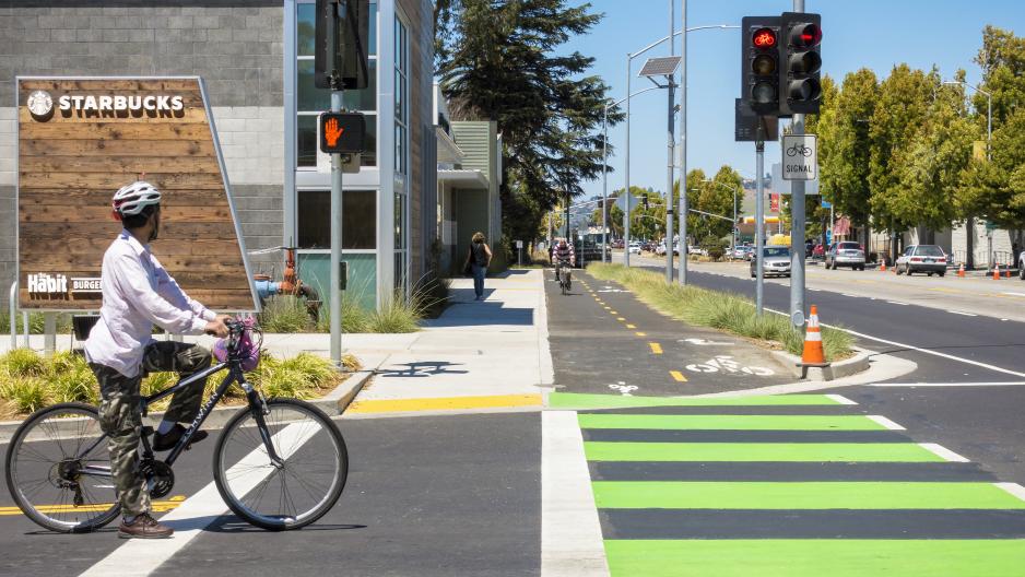
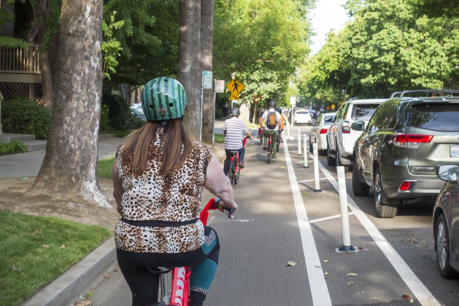
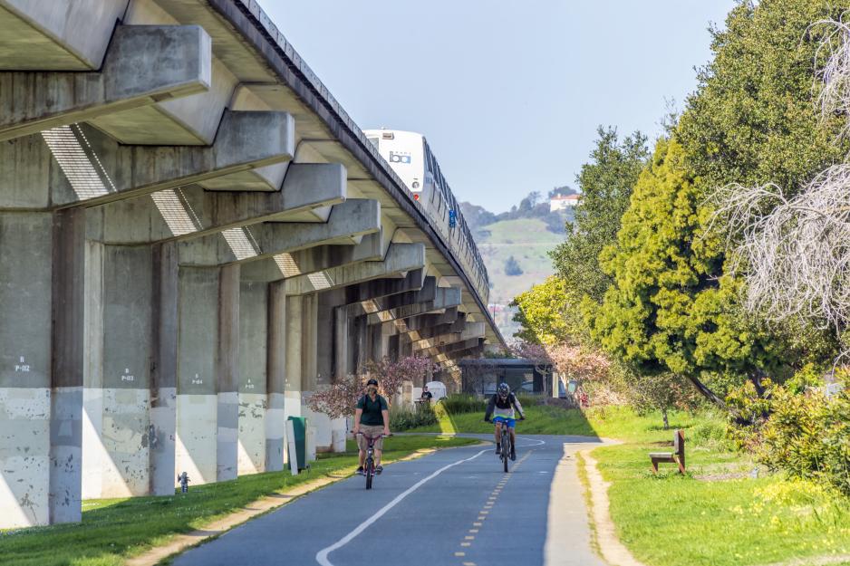
Build bicycle lanes, separated bikeways, and paths. Dedicated bicycle infrastructure improves the travel speed, safety, and comfort for all levels of bicyclists.
- Build lower stress bikeways that support bicyclists of all ages and abilities. Bikeways that reduce vehicle conflicts, provide greater separation from vehicles, and provide ample maneuvering space – attract a greater number and wider variety of bicyclists than higher stress bikeways.
- Provide the appropriate bikeway type for the context. Use tools that measure a bicyclists’ comfort level to determine the type of bikeway to provide.
- Upgrade existing facilities to more comfortable and higher-quality design types. For example, upgrade buffered bike lanes to separated bikeways.
- Connect to the existing bikeway network. New bikeways should connect directly to surrounding bikeway network. Look for opportunities to provide direct connections to trails. Build bicycle/pedestrian-only connections to adjacent developments.
- Identify and accommodate all bicycle movements where bikeways intersect. For example, if a two-way path on one side of the street transitions to bike lanes on both sides of the street the intersection must be designed to permit bicyclists to travel between the two safely and legally.
- Consult VTA’s Bicycle Technical Guidelines for guidance on how to design roads to best accommodate bicycle travel.
Smooth traffic flow through means other than road widening. Many tools and techniques can help smooth traffic flow without significant road widening.
- Make signal improvements at intersections including upgrading signal controls, adding vehicle detectors, installing new traffic signals, removing old signals, interconnecting individual signals into networks, and optimizing signal timing.
- Make small physical improvements at intersections to help traffic to flow more smoothly without substantial road widening such as channelization and re-striping of travel lanes.
- Designate reversible lanes to accommodate peak-direction traffic flows.
- Coordinate traffic signal timing to progress for a set speed. Albuquerque is experimenting with a modified progressive signal system where signals will not immediately turn green if the approaching vehicle is driving over the speed limit. Downtown Sacramento also has traffic signal “waves” timed for lower speeds appropriate for the downtown core.
Reduce conflicts through access management. Access management is the practice of limiting the number of access points on a street and therefore reducing conflicts. By restricting movements and consolidating driveways, access management improves the flow of traffic, reduces crashes, and creates more curb space for amenities such as bus stops, separated bikeways, on-street parking, and street trees.
- Restrict driveway movements. Installing raised medians or channelized islands to permit only certain turn movements can reduce conflict points.
- Reduce driveway width. Wide driveways increase pedestrian and bicyclist exposure to vehicle conflicts and permit fast vehicle turns.
- Signalize driveways. Designing a driveway like a street intersection and signalizing it will reduce conflicts and make the driveway more conspicuous.
- Consolidate driveways. Combining driveways during redevelopment will reduce conflict points. Consolidating driveways outside of redevelopment is challenging and requires agreements between adjacent parcel owners.
Manage curbs. Demand for curb space has increased with the growth of ridesharing, shared micromobility, and online shopping and associated deliveries, bicycle infrastructure, and the continued needs for transit, ADA access, and vehicle storage. Curb management allocates curb space to these competing needs to maximize mobility, safety, and access.
- Consider essential functions of curb space and prioritize curb space based on context-specific needs. Seattle provides one useful example of how to catalogue curb space based on six essential functions of the public right-of-way:
- Mobility: sidewalks and bicycle infrastructure, dedicated transit lanes and general-purpose vehicle travel lanes, right or left turn vehicle lanes
- Access for people: people arriving at their destination or transferring modes of travel. Transit stops, passenger loading/unloading zones, taxi zones, bicycle parking, bike share docking stations, dedicated parking for dockless bike share or scooters
- Access for commerce: commercial vehicle or truck loading zones
- Activation: vibrant social places that encourage people to gather. Food trucks, restaurant patios or sidewalk cafés, parklets, public art, street festivals, and farmers markets
- Greening: planting strips, bioswales, street trees, planter boxes, rain gardens
- Storage: private vehicle parking, bus layover spaces, reserved spaces (e.g., police or government vehicles), bicycle parking.
- Flex curb space. New private sector transportation business models such as rideshare, on-demand delivery, micromobilty, and employee shuttles are disrupting the way streets, and particularly the curb are used. Flex zones are flexible areas of the curb that can accommodate different functions of curb space along one segment of street. These can include serving multiple functions simultaneously in one location (e.g., combined commercial and passenger loading areas), time of day restrictions (e.g., peak-period travel lane used for off-peak parking), converting what was a single-function curb to multiple functions along a segment of street (e.g., converting parking to parklets, designated loading zones, and curb extensions on the same block face).
- Virtually assign pick-up and drop-off zones. For areas with high demand consider geofencing to establish pick-up and drop-off zones for on-demand rideshare services. Geofencing can also be used to define permitted parking areas for shared micromobility such as dockless bicycles and scooters and time-of-day or location-based delivery zones.
- Manage freight loading. Depending on priorities for the corridor, it may be possible to move commercial loading zones to adjacent blocks, around the corner, or to an alley. In dense residential areas, it may be preferential to designate loading zones for delivery trucks that don’t overlap with bicycle or transit corridors. Providing a reliable, legal loading zone can offset the increased distance to the destination.
- Prioritize mobility and access for people over storage for private vehicles. Particularly in high-density, mixed-use areas well-served by transit, the most efficient way to travel is often not a private vehicle. In these areas, private vehicle parking should be de-prioritized in favor of curb uses that provide mobility and access. These include but are not limited to: separated bikeways and other bike infrastructure, wider sidewalks and curb extensions, on-street bicycle parking, on-street shared bikeshare or scooter share parking, carshare parking, accessible parking/loading zones, bus boarding islands, dedicated transit lanes, parklets, and green infrastructure.
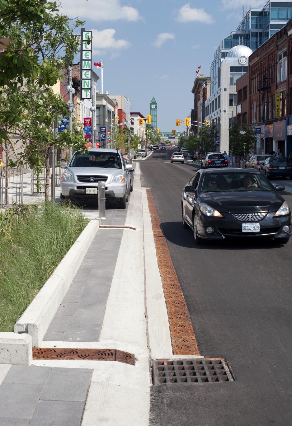
Green stormwater infrastructure. Paved areas like streets and parking lots form an impervious barrier on top of the earth, disrupt the hydrological cycle, and require expensive infrastructure to manage stormwater runoff and protect water quality. Surfaces that allow stormwater to percolate through to the ground serve as natural biofilters, helping to clean stormwater of its pollutants before it reaches streams and other waterways. They also reduce flooding by regulating the flow of water back to waterways.
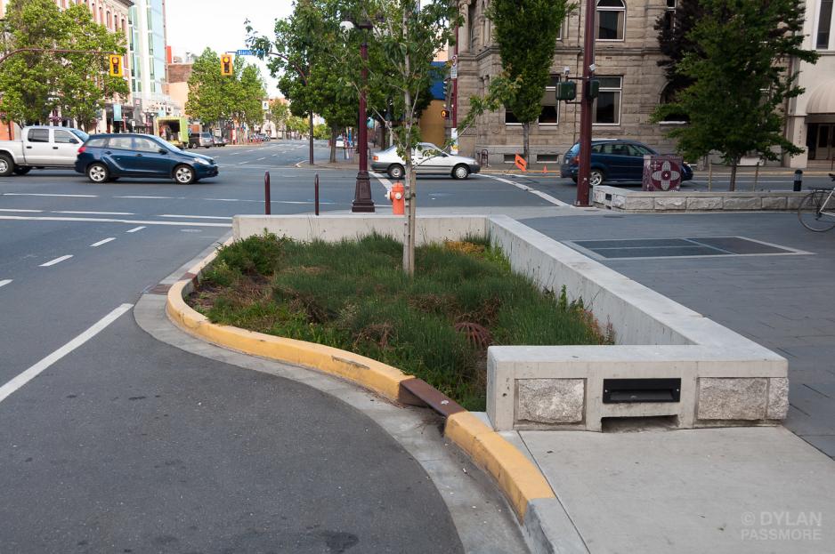
- Select green stormwater infrastructure that is appropriately sized and configured for each location. Potential applications include in curb extensions, at the back of a transit stop, at the end of a bus boarding island, in a floating island that separates bicyclists from moving vehicles, in the median. Designs should be customized for each location to provide the necessary performance for stormwater management and maintenance needs should be considered from the beginning.
- Bioretention planters and biofiltration planters are walled planters that either permit stormwater to percolate into the underlying soils or to an underdrain. They are commonly installed in medians, in the sidewalk furnishings zone, in parking lots, or along the property line. They should be installed to not impede pedestrian access and cannot impede accessible parking spaces, loading zones, or bus stops. Provide pedestrian cut-throughs approximately every 20 to 40 feet to permit access to the curb.
- Bioretention swales are shallow, landscaped depressions with sloped sides that capture stormwater and treat it before allowing it to flow downstream. Swales have little or no vertical separation from the sidewalk and street and typically require wider areas than planters. They are best suited for areas with lower foot traffic, such as residential streets, along shared use paths, medians, or unused right-of-way.
- Swales and planters can be combined to provide a walled curb at the street and a level planted area at the sidewalk.
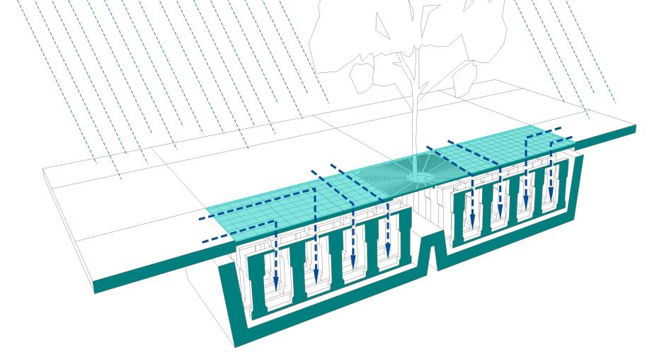
- Tree wells or pits can be used as green stormwater infrastructure. Tree wells and pits must provide adequate space for the tree roots under the sidewalk or street. Overhanging tree branches should not impede pedestrians, bicyclists, or transit vehicles.
- Permeable pavement can be used for areas with low traffic volumes and few heavy vehicles. Bikeways, parking lanes and sidewalks may be appropriate applications. Permeable pavement includes pervious concrete, porous asphalt, permeable interlocking pavers, and grid pavers.
