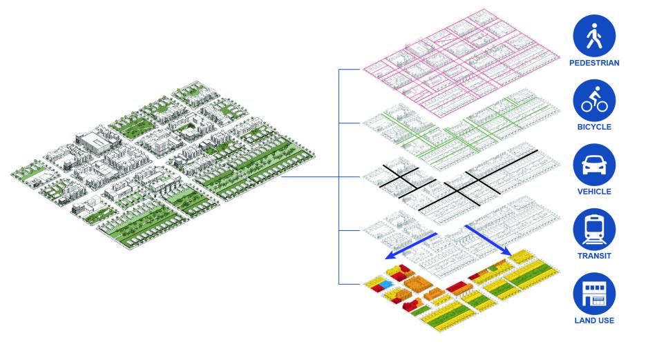
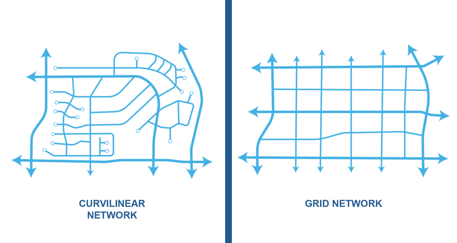
A well-connected network of streets makes it easier to walk, bike, and take transit and distributes traffic load among many streets rather than concentrating it on any one street. As a result, it is easier to provide roadway space for pedestrians, bicyclists, transit, landscaping, and other amenities. Interconnected streets move local trips off the arterial network. A dense system of low-speed, low-volume streets provide more people with the choice to walk safely and comfortably.
Take a layered network approach to the transportation network.
- Set modal priorities with the entire network in mind. Public right-of-way is a limited resource.
- Consider the system as a complex web where the transit network, the bike network, and the motor vehicle network all overlay each other, sometimes overlapping, sometimes not. Networks operate at different scales: pedestrian networks are fine-grained with closely spaced parallel routes, while motor vehicle networks can work with parallel routes spaced farther apart.
- Allocate roadway space based on how important a roadway segment is for each of the layered transportation networks. For example, a street may be prioritized for transit and pedestrian access to transit while private vehicles and bicycle access are prioritized on other nearby parallel corridors
Body
Create a connected network of streets, sidewalks, and bikeways.
- Streets should follow a grid pattern and avoid loops or cul-de-sacs that limit multi-modal access to peripheral streets. Where cul-de-sacs exist, connect the network with sidewalks and bike paths.
- Connect internal site circulation network to external public networks, with priority for creating continuous network for pedestrians and bicyclists.
- Provide new streets or side streets during redevelopment to break up large-scale blocks.
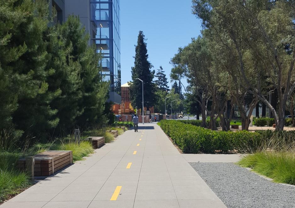
- Provide clear and direct pedestrian connections between buildings, sites, transit stations, parks, and other amenities to ensure safe and comfortable walking.
- Provide continuous sidewalks along all streets, regardless of nearby land uses. Eliminate pedestrian barriers such as fences, sidewalk gaps, large crossing distances, and lack of crossing points.
- Ensure local projects and plans support strategic regional planning efforts to provide multi-jurisdictional transit, cross-county bicycle corridors, trail systems that link communities, and new connections across regional barriers such as freeways.
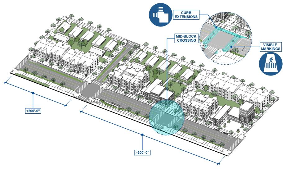
Provide convenient and safe pedestrian crossings on all streets. People choose to cross a street considering both convenience and perceived safety. When crossings are far apart, pedestrians may cross at a less-safe location because the safer location is significantly less convenient.
- Provide marked crosswalks at intersections. Marked crosswalks should be provided at all legs of signalized intersections. Controlled crossings on higher volume or higher speed streets should have a marked crosswalk. On lower volume (<3000 average daily traffic) or lower speed (<20 mph) streets, marked crosswalks may not be necessary at all intersections.
- Provide pedestrian crossings to serve destinations that attract pedestrians. Even outside of areas with high pedestrian activity, bus stops, schools, libraries, senior centers, hospitals, parks, and other destinations may benefit from marked crosswalks. Consider mid-block pedestrian crossings if there is a significant desire line that isn’t served by the street network.
- Consider future land use and pedestrian volumes when determining when to install a new pedestrian crossing. The California Manual of Uniform Traffic Control Devices provides guidance for determining when a signal is warranted. When using these warrants, engineers should also take into account future land use changes, future pedestrian volumes, and other built environment factors
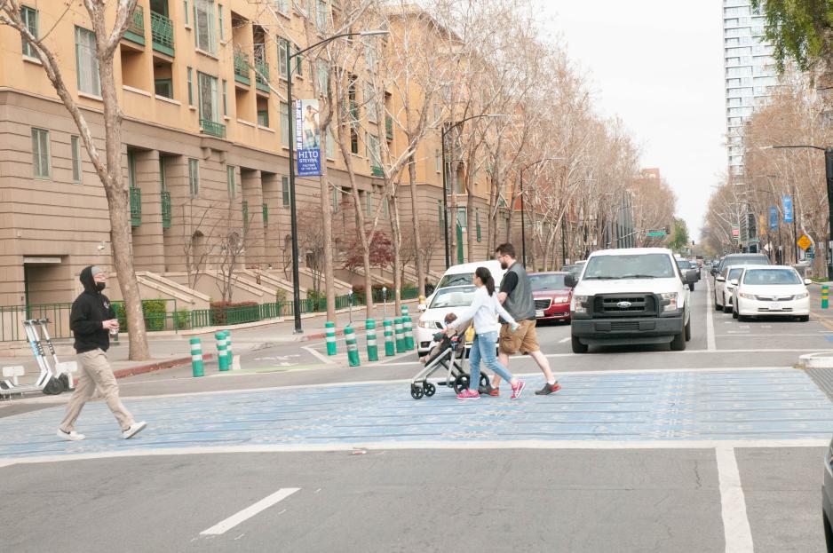
- Provide safe, visible, and conspicuous pedestrian crossings, with particular attention on midblock and uncontrolled crossings. Review conditions at each crossing location and provide context-appropriate advance warning signs, markings, and pedestrian-activated beacons.
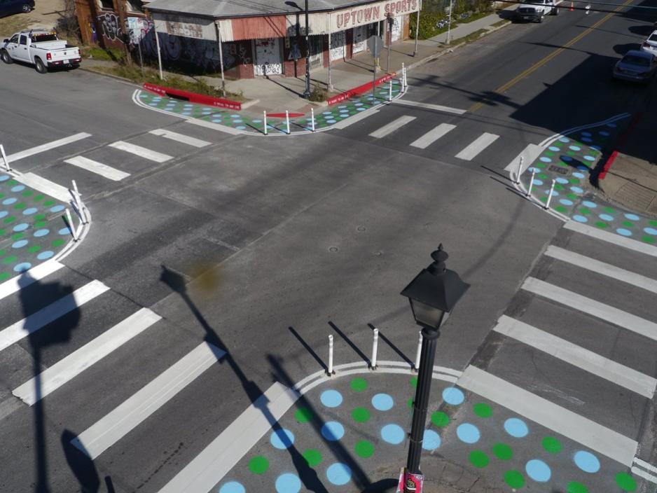
- Shorten crossing distance and increase pedestrian visibility with curb extensions, road diets, and other similar treatments. Increase crossing conspicuity with street lighting and high-visibility crosswalk markings.
- Design and operate signals to reduce pedestrian delay, particularly in areas with high pedestrian volumes. Consider automatic pedestrian signals as an alternative to pedestrian-activated signals. Delays exceeding 40 seconds at signalized crosswalks and 20 seconds at unsignalized or yield-controlled crosswalks may cause risk-taking behavior.
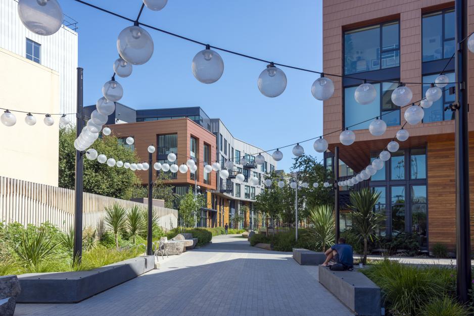
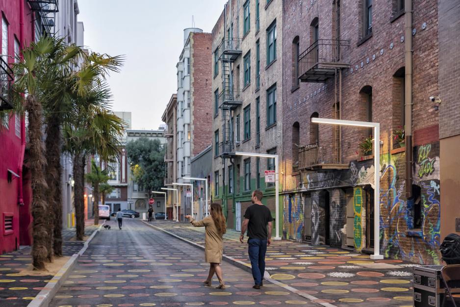
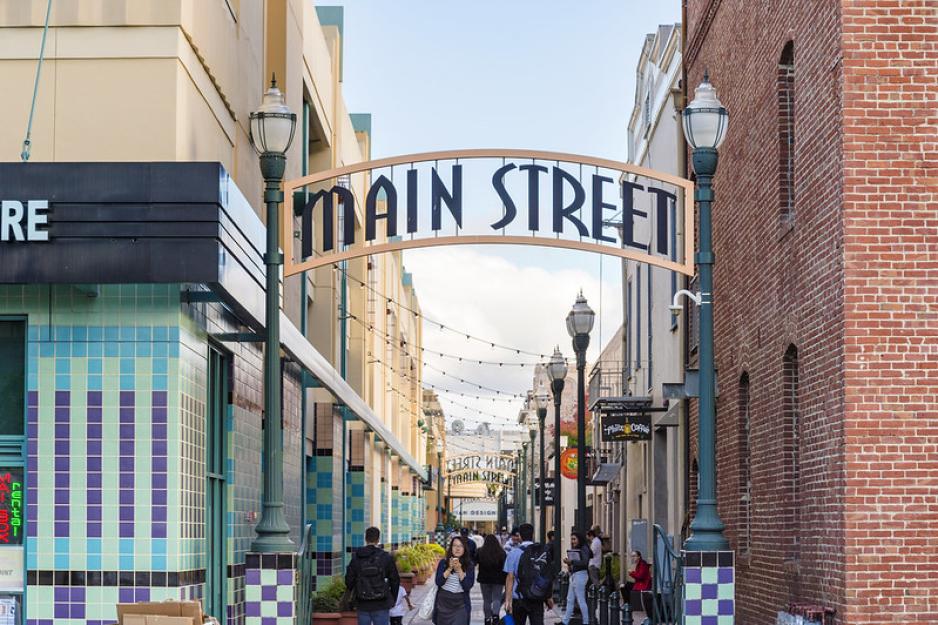
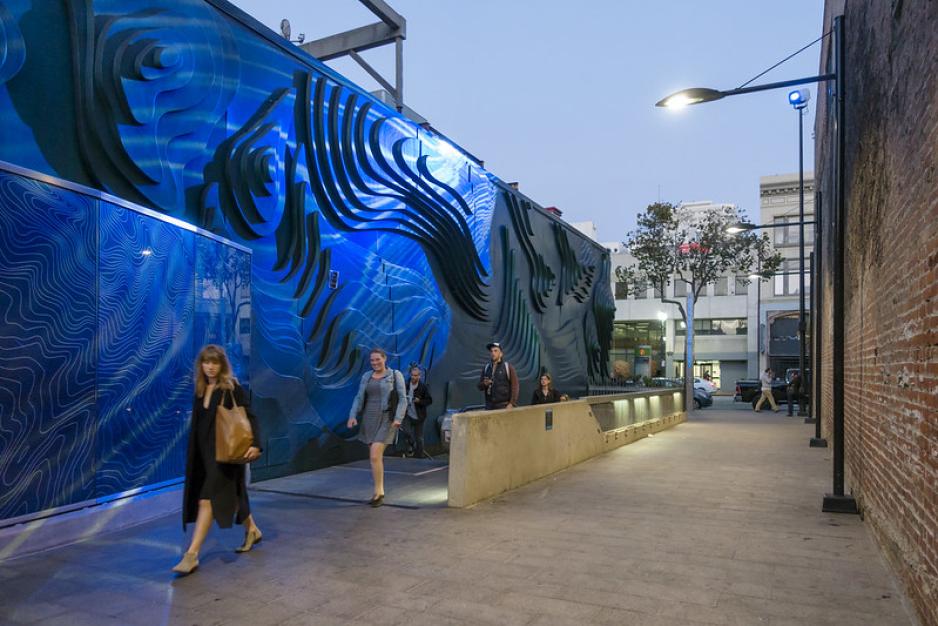
Use side streets and alleys creatively to break up larger blocks to create additional pedestrian connections and reduce pedestrian / vehicular conflicts. They may also provide an opportunity for pedestrian-oriented community space where neighbors meet, children play, or community events are held.
- Utilize side streets and alleys for motor vehicle storage, utilities, and deliveries so that the fronts of buildings can be designed for pedestrians.
- Design side streets and alleys to improve pedestrian comfort. If pedestrians are intended to use side streets or alleys, employ design treatments to improve their feel, including high levels of lighting, street-facing windows and doors to improve security, architectural gateway features, alternative paving materials, landscaping and planter boxes, and adequate screening for utilities.
- Retrofit selected commercial side streets and alleys to be more inviting, more effective as mid-block connections, or simply more functional.
- Secure an operation and maintenance plan for diligent cleaning and maintenance to keep side streets and alleys inviting.
