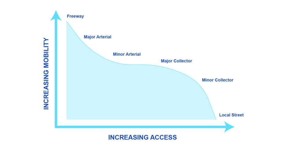
The functional classification system defines streets based on two features: travel mobility and access to adjacent property. However, this system has limitations.
Functional classifications are required. Jurisdictions are required to assign streets functional classifications defined by Caltrans using guidance from the Federal Highway Administration in order to receive Federal funding. The classification system defines streets based on two features: travel mobility and access to adjacent property.
- There are limitations to the functional classification system. It focuses on vehicles. It does not consider local context and adjacent land uses. It does not recognize the important role streets play as public spaces and places that determine the character and livability of our communities.
- These limitations can be addressed by being flexible in design and developing local context-sensitive street overlays that define multimodal priorities and desired placemaking features.
- Additionally, cities should periodically recalculate assigned functional street classifications. If street use has changed over time, consider changing the assigned functional street classification. As land uses intensify and streets see more pedestrians and transit riders, original design speeds may not match the new nature of the street. Changing the functional classification may permit lower design speeds to improve safety.
Build in flexibility. Use engineering design discretion to design streets in context with surrounding land uses. Look at the full range of values provided in design manuals, rather than default to the maximum or minimum parameters. Caltrans Highway Design Manual, 82.2 (5) delegates authority to local agencies for the design decisions they make on transportation facilities they own and operate. Design decisions should be documented.
- Expand design references to include guidelines that specialize in on pedestrian, bicycle, transit, and green infrastructure. Caltrans 2014 Memorandum, “Design Flexibility in Multimodal Design” and Federal Highway Administration’s 2013 Memorandum, “Bicycle and Pedestrian Design Flexibility” list design guides that local agencies may wish to refer to, including those published by the North American City Transportation Officials, American Association of State Highway and Transportation Officials, and Institute of Transportation Engineers.
- Refer to state and national publications on flexible design. Caltrans, the Federal Highway Administration and others have developed useful guidelines for designing streets that respond to local context, expand walking, biking, and transit options, and balance local mobility and placemaking needs with regional travel.
