Outside of major cores, sizeable development projects are often comprised of multiple buildings that together approach the scale of independent districts. Many important urban design decisions are made at the project level, ranging from architectural and site planning issues to street design and connections, types and locations of land uses, and the provision of parks and open spaces. Staff must recognize the need to balance local objectives with the regional impacts that projects have and remember that regional projects have local roles.
Projects designed to integrate well with other developments, nearby amenities, and transportation resources can become effective building blocks of good districts and neighborhoods — and can revive and enliven areas that have experienced decline.
Conceive and design for a whole district, pending a high level of connectivity and integration.
- Organize districts around an identifiable center, where transportation, basic services, and public gathering places are concentrated.
- Provide usable and accessible parks and public spaces of varying sizes.
- Manage vehicle parking and design to encourage use of multiple modes of transportation.
- Implement Transportation Demand Management.
- Allow complementary land uses appropriate to district type.
Put density where it belongs: land use programs should reflect the context of transportation investment.
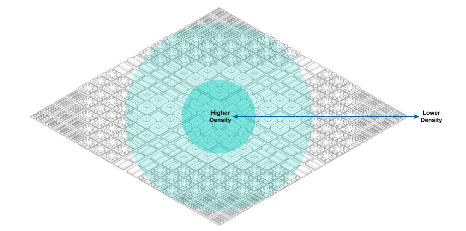
- Direct and encourage density and development to cores, transit-rich areas and corridors, priority development areas, and other neighborhoods or centers identified for development by the local agencies.
- Establish minimum density levels. While cities will determine the level of intensity appropriate for their jurisdictions, they should adhere to at least a minimal land use density essential for supporting basic transit service of at least 75 dwelling units per acre (DUA) in residential areas. Investments in light rail, commuter rail/BART, and Bus Rapid Transit (BRT) corridors can support higher densities. Many transit and pedestrian-friendly neighborhoods can have densities above 100 DUA or higher in dense urban cores.
- For Transit-Oriented Communities of 500-600 acres or more, developers should provide less density at the edges and where parcels touch existing low-density, single-family neighborhoods. As an example for these communities, minimum design could include townhouses around edges, podium/wrap inwards from edges, and mid-rise and high-rise development closest to stations where there is current or future market support and it can be successfully integrated into urban design (e.g., no excessive shadows on parks).
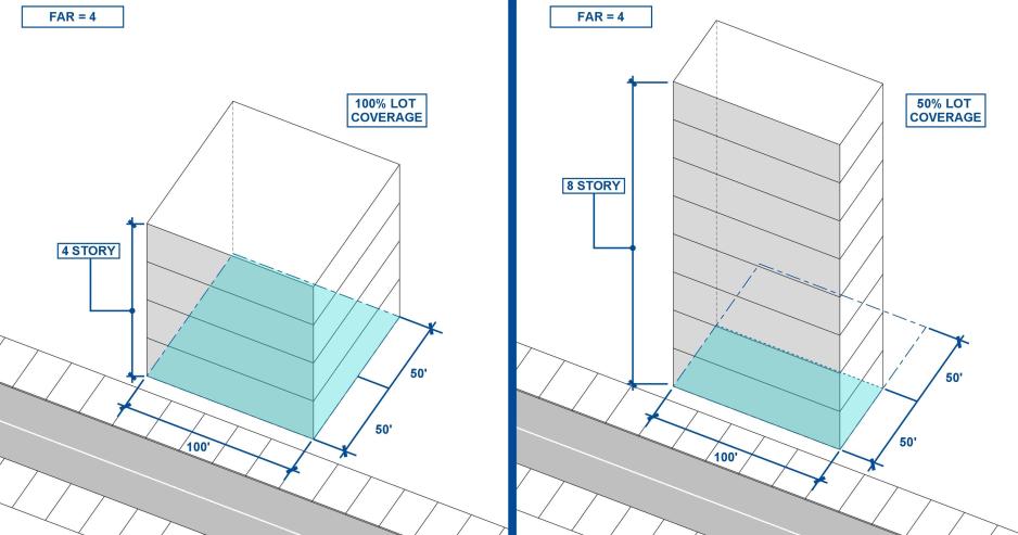
- Employment areas having a floor-to-area ratio (FAR) of four or more may be appropriate for dense urban cores.
- Remove policy and monetary incentives for “greenfield” development far from transportation resources. Mitigate or remove the disincentives for infill development and streamline the development process in these areas.
- Require developers to build to planned densities set by the planning process.
Encourage mixed-use projects, particularly those that combine office, retail, and residential uses within the same site or building.
- Provide for more than one need in a single area. In predominantly single-use projects, incorporate selected uses that serve as public amenities.
- Provide a public interface. Buildings designed for several employees should have ground floor connections to the public realm. Cafeterias, exercise facilities, and company stores should all be considered candidates for public access.
- Provide a balance of market-rate, affordable, for-sale, and rental properties. Projects with a residential component should provide a variety of housing types of multiple sizes.
- Provide a better balance between jobs and housing.
Design and plan for transit by making station areas the focus of special design attention, emphasizing higher densities, mixed uses, pedestrian amenities, public space, and a range of useful services. Design pedestrian connections and project street networks to provide direct access to transit and accommodate transit access to interior points within a community, not just the periphery.
- Design driveways and other vehicle access points so that they do not cross from light rail lines to avoid vehicles queuing on tracks.
- Work with VTA to consider planned service improvements and transit facilities in project design and layout.
Connect with surrounding projects and amenities through a street network designed to balance and support multiple modes of transportation.
- Provide a street network that is direct and efficient. Equal emphasis should be given to all modes of transportation.
- Close gaps in the pedestrian and cycling network to provide continuous, accessible multi-modal access. Extend sidewalks and pathways beyond the project boundary to make connections to adjacent projects or amenities.
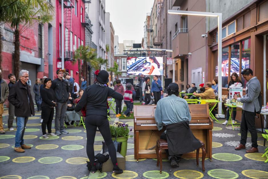
Use alleys and rear lanes to support a pedestrian oriented streetscape.
- Use design features to associate garages, alleyways, and rear lanes with living units and make alleys more user-friendly and functional.
- Include human-scale lighting and landscaping as well as multiple access points to encourage pedestrians and increase safety.
- Provide designated, well-screened spaces for trash receptacles and utility access.
- Use detached garages and planter areas to create a “courtyard” effect and provide more private areas within the yard.
Plan and design civic projects that last and inspire.


